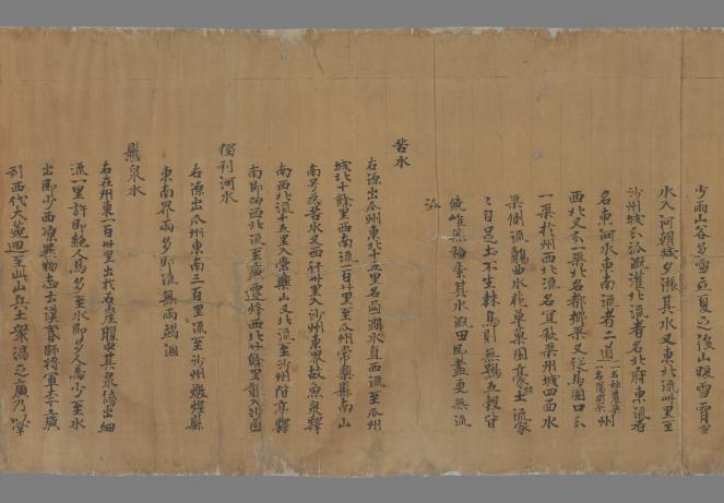
This project analyzes the formative stages of geographical knowledge in dynastic China between the Eastern Han (25–220 CE) and Tang (618–907 CE) eras. It focuses on the representation and understanding of local diversity in the plethora of geographical writings composed before the printing era. Many are preserved only in the empire-wide geographies and encyclopaedias of the Song (962–1279) and have hitherto been studied mainly with regard to teleological issues of linear transmission. By cross-referencing these Han-Tang fragments with the MPIWG databases and re-arranging them topically and geographically, their mode and context of production comes to the fore. These texts bear witness to the heterogeneity of geohistorical information before the surge of local gazetteers. What’s more, by exposing how the local informs the imperial center, local writings give view to the regional diversity of a space that historiography mostly addresses for its attempts towards unified rule.

Part of the first fragment (juan 卷 3) of the Shazhou tujing 沙州圖經, an early Tang (7th-8th c.) manuscript (P. 2005) found in Dunhuang (Western China). Bibliothèque nationale de France and International Dunhuang Project.

