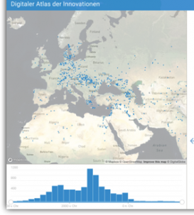
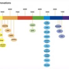
The interconnections between technical innovations and the spread of knowledge cannot be researched without analyzing their spatial and temporal context. Generating and testing hypotheses concerning the spread of innovative ideas and that visualize the geographical constraints, has proven to be a valuable method in different projects. Spatio-temporal visualization helps to uncover connections between different developments by simply analyzing overlaps and distances. It also shows dynamical changes and trends of centralization and decentralization. From the network perspective, these relations form another layer of the complex systems of multi-layer networks. The development of an ecosystem of tools for analyzing geographical connection is centered around PlATiN (Place And Time Navigator), a tool for representing, analyzing, and filtering spatio-temporal data. PLATIN is an interdisciplinary and inter-institutional endeavor involving the excellence cluster TOPOI and the European infrastructure initiative DARIAH. It is available as an open source tool and is also used by various other research projects.

Project
(2017-2024)

